

I always look forward to photographing the Adidas Marketing conferences, and this year’s event at Factory International in Manchester was nothing short of spectacular. Working alongside Jules from TOL Events, who consistently delivers remarkable experiences, I was excited to capture every moment of this high-energy gathering.
Read More
Documentary Photography - BP's LiDAR buoy at Liverpool Docks
Another commission from BP as they work on the development of the Mona and Morgan Irish Sea wind farms. This time I was taking photographs to document the maintenance of one of their Fugro Seawatch LiDAR buoys which are surveying the field to find optimal wind turbine locations. The Seawatch buoys run on solar panels and fuel cells using methanol fuel. Although autonomous in the field the buoys need to be towed to shore for refueling and servicing.
Read More
On board the Fugro Synergy for BP
By far the best thing about working as a professional photographer is the variety of the work. The camera can gain you access to environments that are wildly different each shoot day and if you’re lucky, can sometimes take you to some incredible and unexpected places. One of the most interesting of my shoots in 2022 was an assignment from bp to photograph the crew and workings of the Fugro Synergy while on a recent stop at Liverpool docks.
Read More
Bruce Grobbelaar for 11 Freunde
A recent commission to photograph Liverpool FC legend Bruce Grobbelaar for German football magazine 11 Freunde.
A total gent who even bought me a beer at the end of the shoot, I think that’s the first time that’s happened in 20 years!
Read More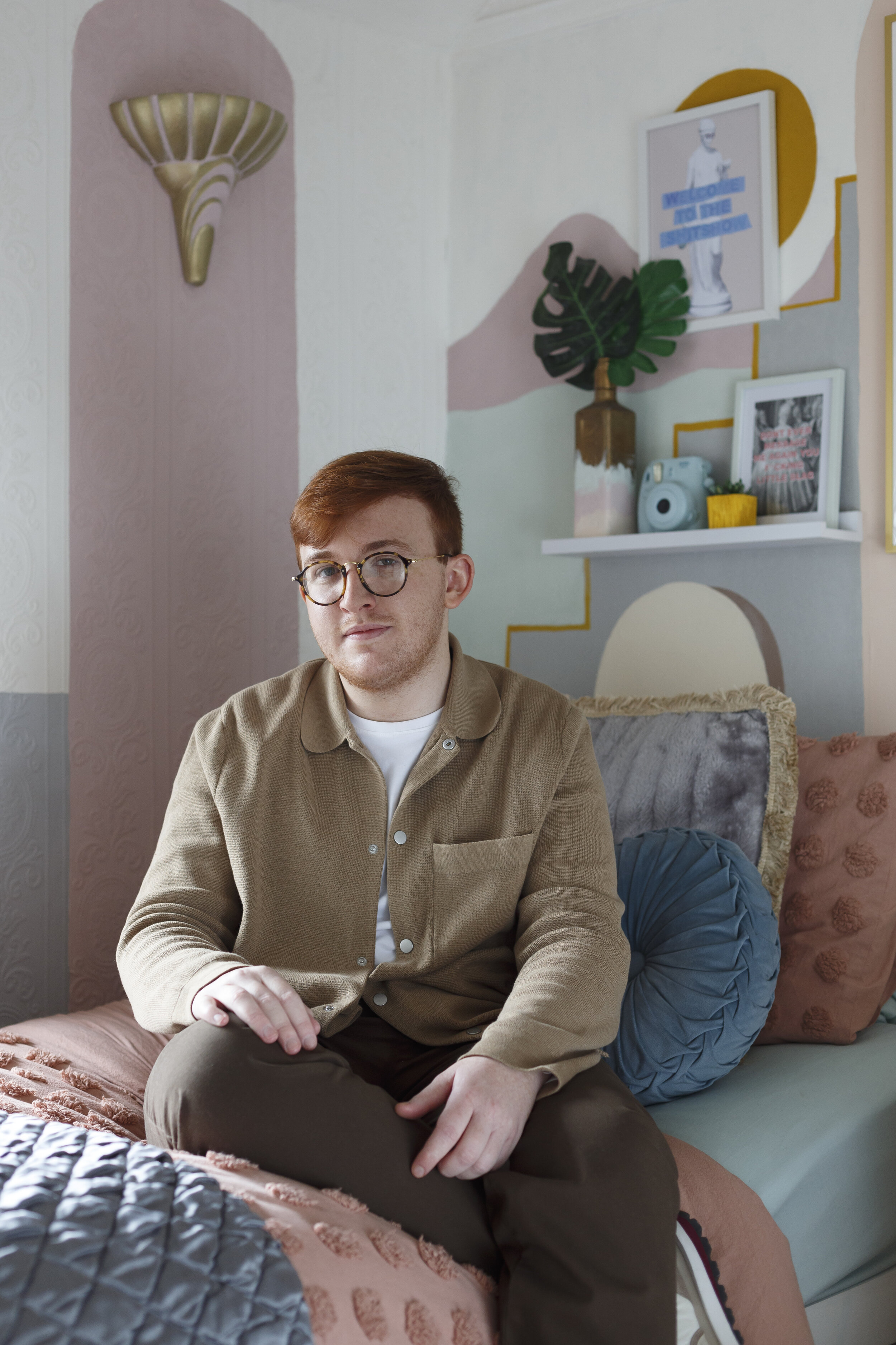
Bradley Dreha for Dwell Magazine
When Bradley Dreha revamped his bedroom he decided to post before and after pictures on TikTok. The results were so good that San Francisco based design magazine Dwell got in touch to ask him for an interview.
Dwell then asked me to visit Bradley at his home in Walton, Merseyside to photograph him and his room for the latest issue of the magazine.
You can see more of Bradley’s work on Instagram @shitprints2
Dwell magazine can be found at dwell.com
Read More
Travel in the time of Covid. An assignment for Transport for the North
Another great assignment for Transport for the North this time looking at the transport infrastructure in Liverpool and Sheffield and how it was dealing with the impact of Coronavirus.
Read More
Barnfather Wire for HTP Digital
Barnfather Wire is the UK’s largest independent wire production company. I was commissioned by long-time collaborators HTP Digital to visit the factory in Wednesbury to produce images for the company’s new website.
Read More
Phoenix Healthcare distribution for Fagan Jones
A shoot documenting the high technology pharmaceutical facility in Preston Brook commissioned by the wonderful Vicky at film production company Fagan Jones. I was once again shooting stills alongside the exceptionally talented film cameraman Dan Lightening.
Miles and miles of robotised, computerised conveyors pick, sort and pack drugs for distribution to pharmacies around the country.
An enjoyable and very busy day that reminded me that running shoes are required equipment for photography professionals.
Read More
BeClear Orthodontics for What Marketing
During the quiet times of our coronavirus disrupted summer it was great to get a call from the team at What Marketing to work with them on a shoot for cosmetic dentist BeClear Orthodontics.
Read More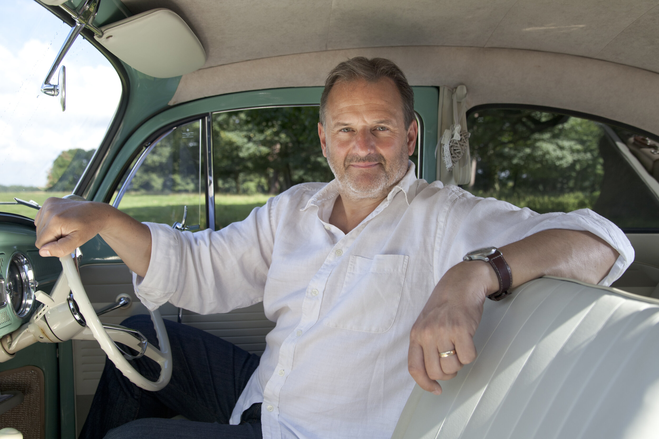
Mark Radcliffe for the Daily Telegraph
Mark Radcliffe is as nice in person in real life as his radio persona would suggest. Music nerd, City fan, all round good egg.
I’ve photographed him a couple of times, here in Dunham Massey country park in Cheshire with a beautiful vintage VW Beetle for a motoring feature in the Daily Telegraph.
Read More
British Ecological Society Summer School
The British Ecological Society’s summer school is a week long residential field experience for students studying sciences at A-level, Scottish Higher and other similar qualifications. This year 31 students from 7 different schools across the UK gathered at Malham Tarn in the Yorkshire Dales. I was there as documentary photographer giving an overview of the day’s activities and providing marketing and social media material.
As ever, working for BES was extremely interesting, a personal highlight being the nature walk led by Dr. Daniel Forman, lecturer in Biosciences at Swansea University. I’d walked the same route as part of the Pennine Way last year but his fascinating insights into the ecology around us was illuminating.
Read More